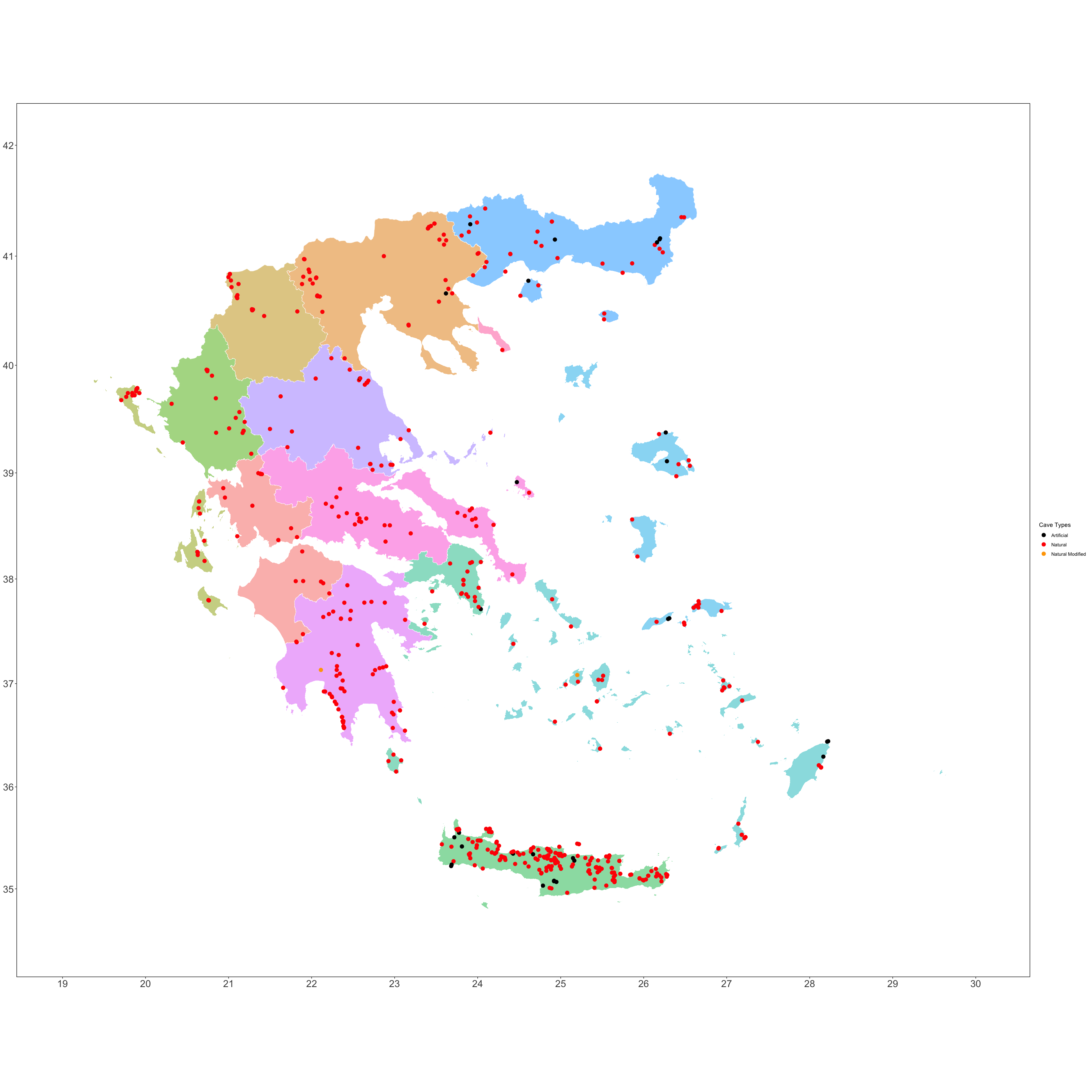
Spatial Analysis
In this analysis we used spatial data (e.g shapefiles) to enrich the cave fauna of Greece. We incorporated the shapefiles as detailed below:
- Greece administrative data geodata.gov.gr
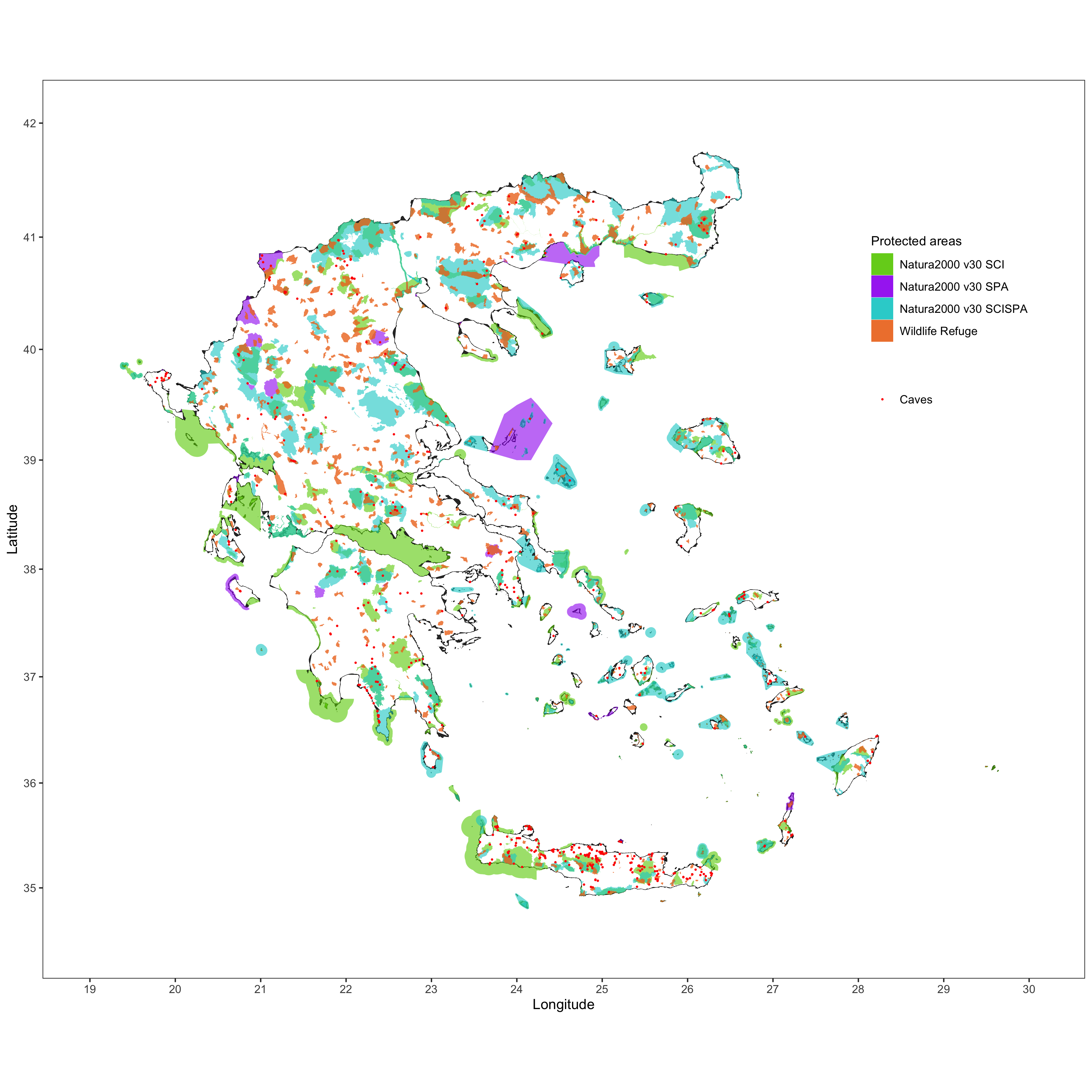
- Natura 2000 areas
- Wildlife refugees
We used these packages for the analysis in R:
Administrative data of Greece
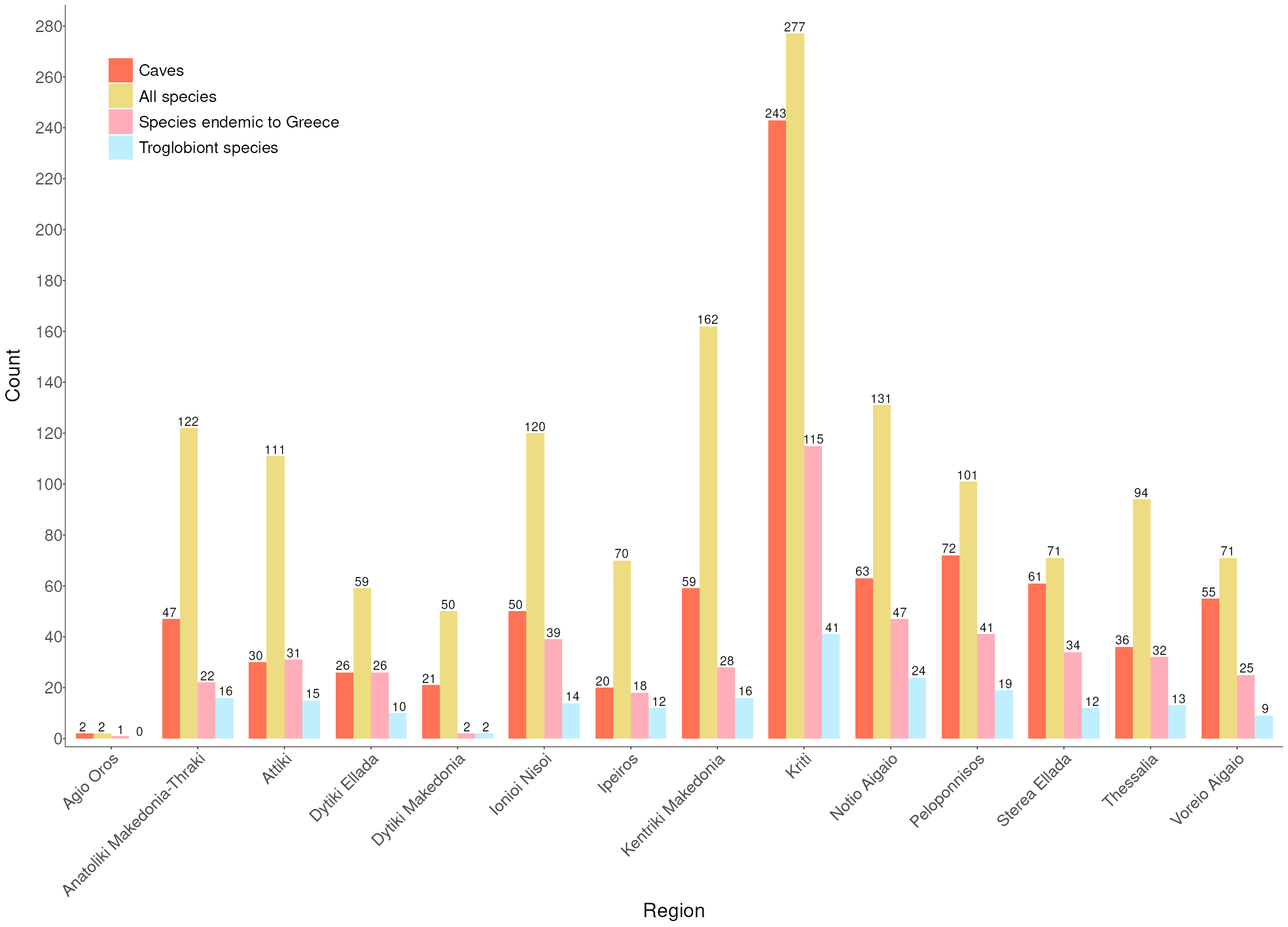
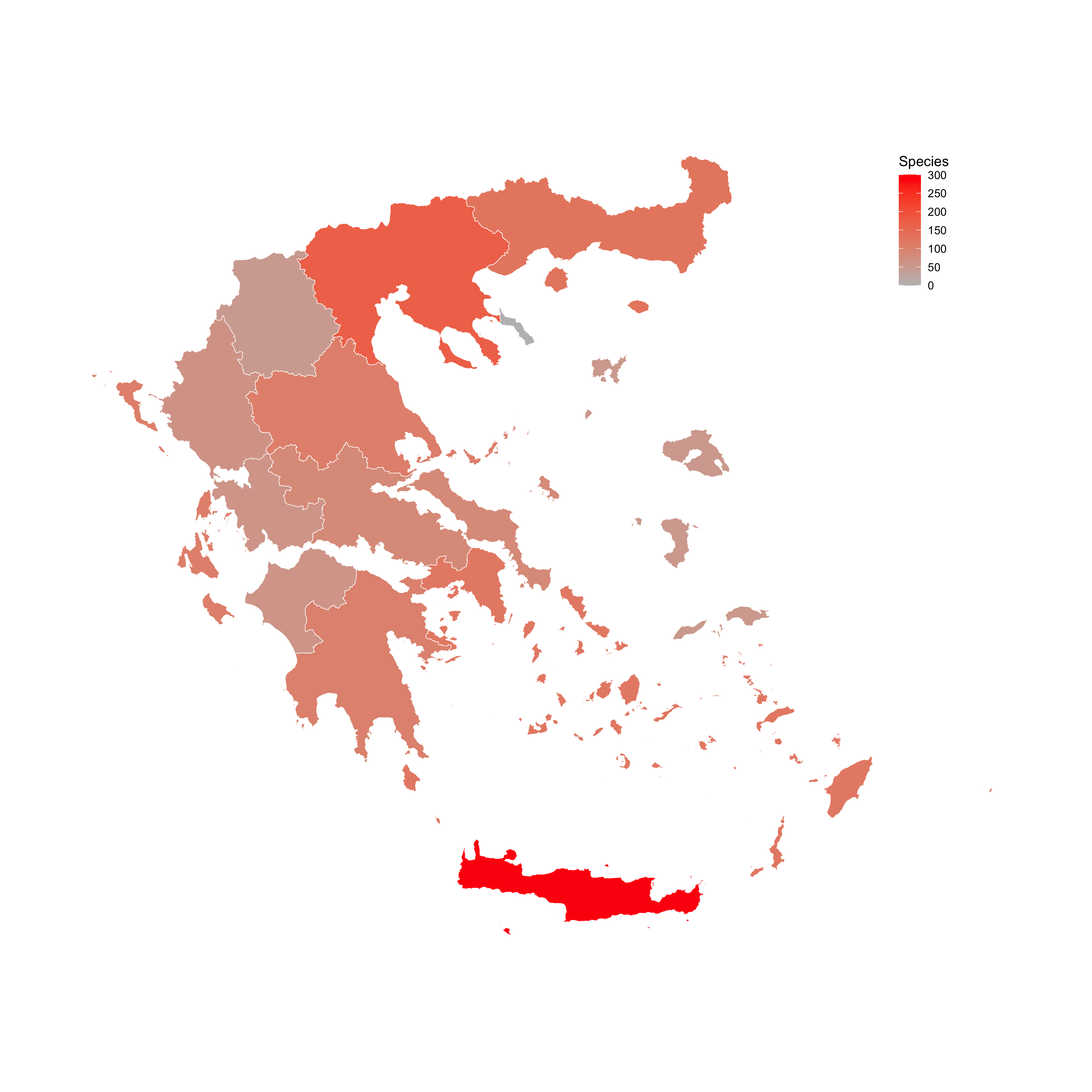
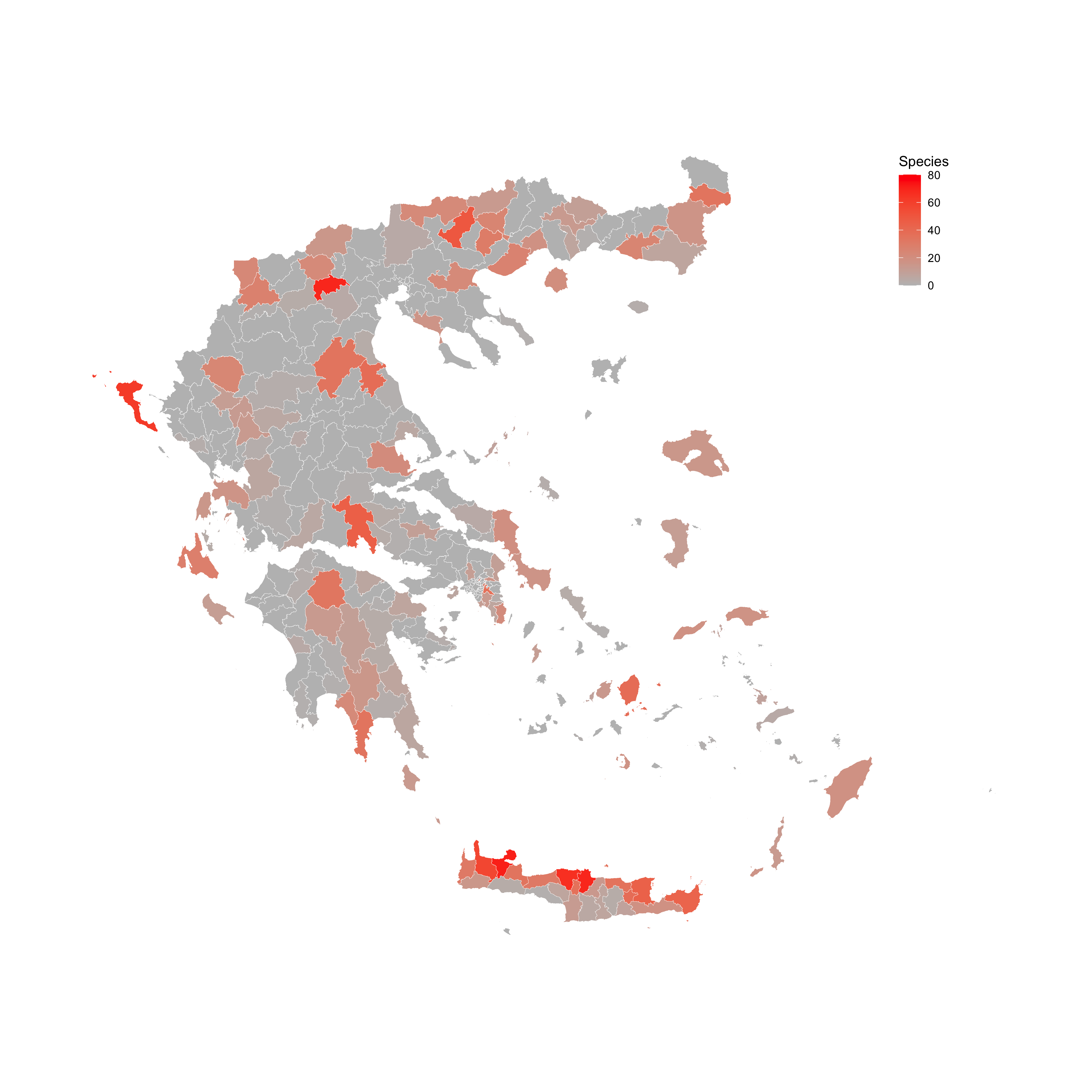
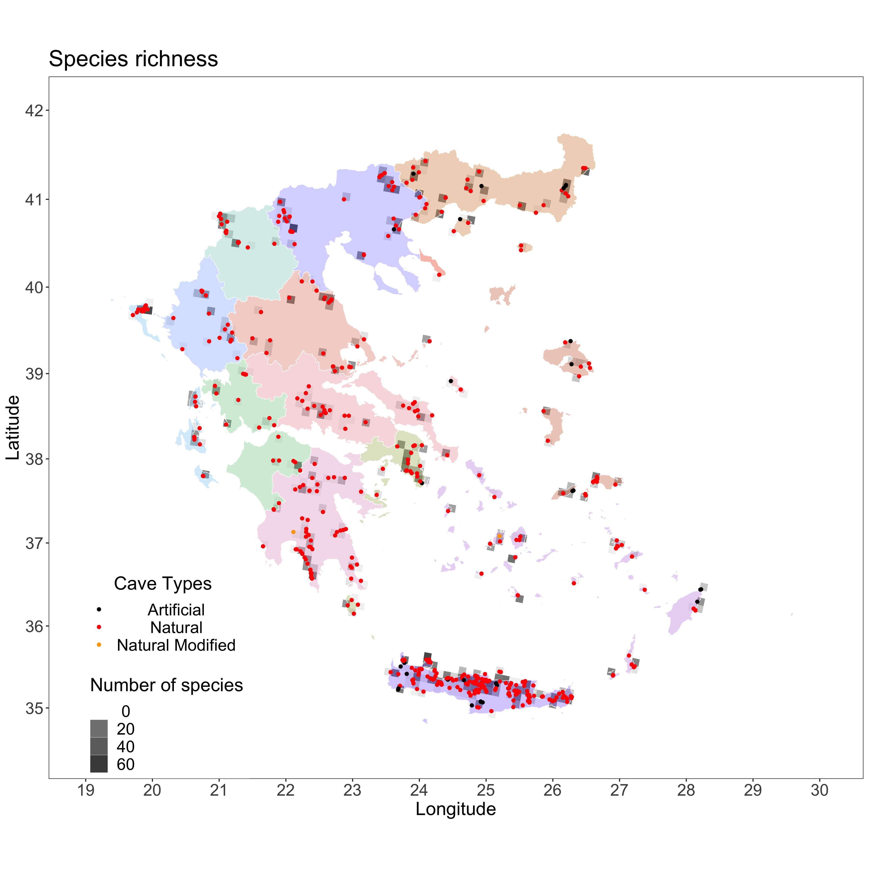
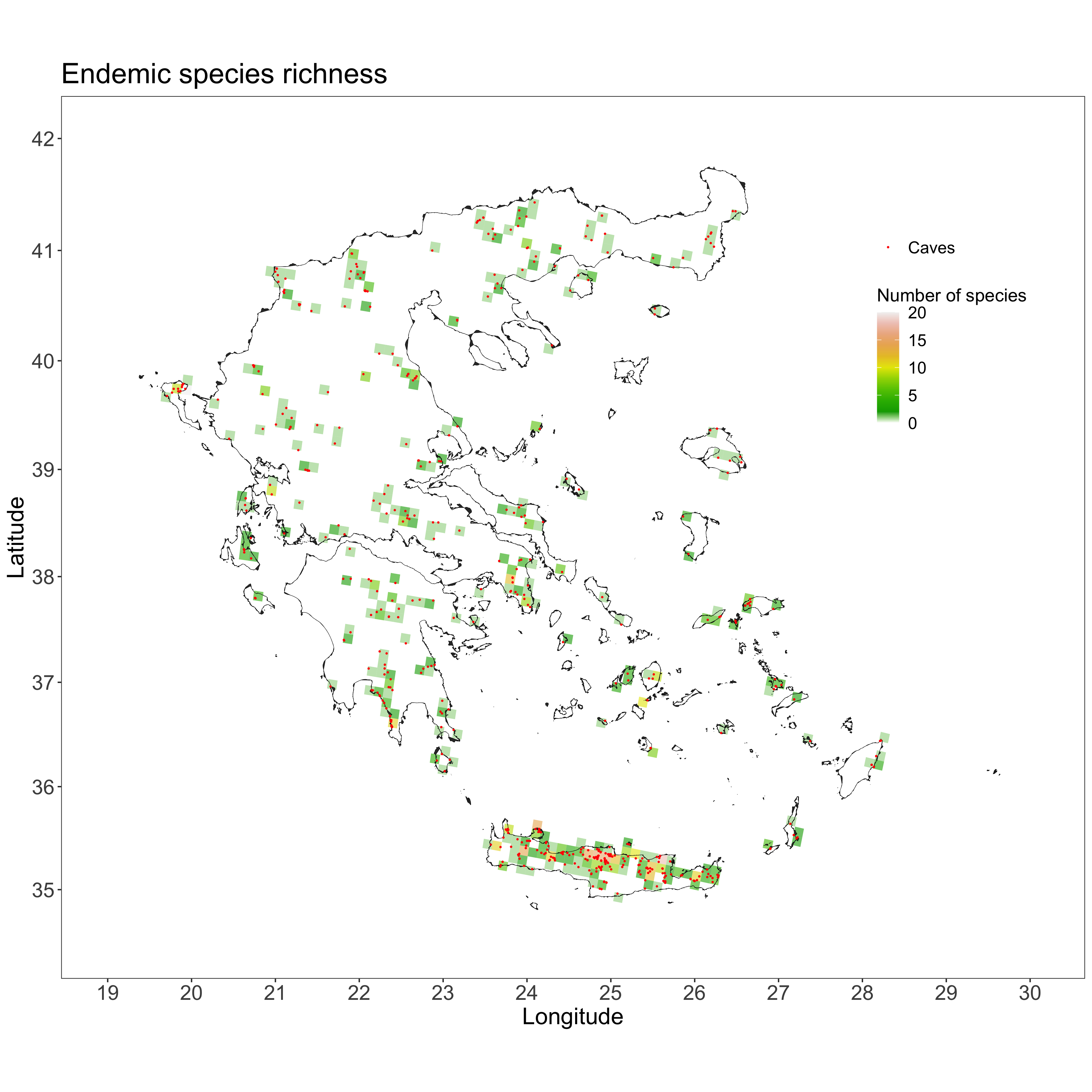
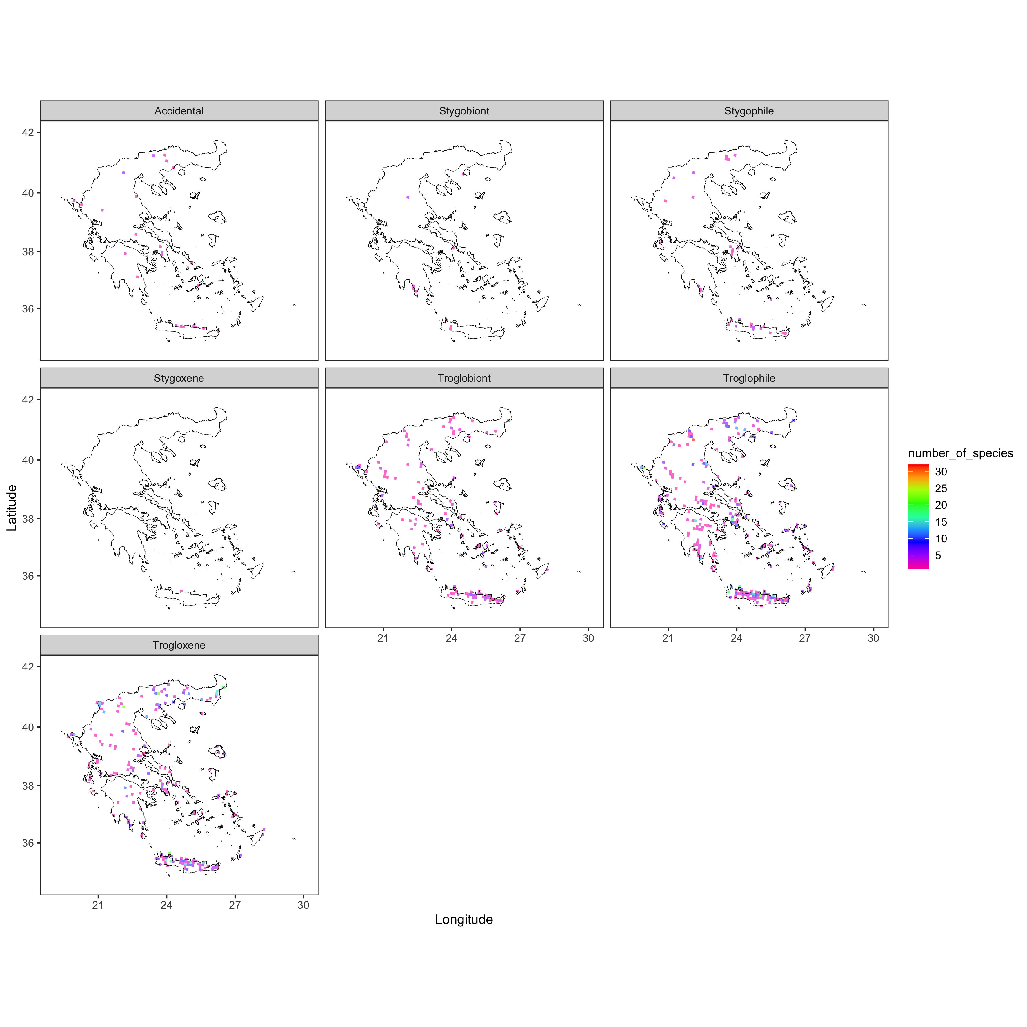
Species and caves per region
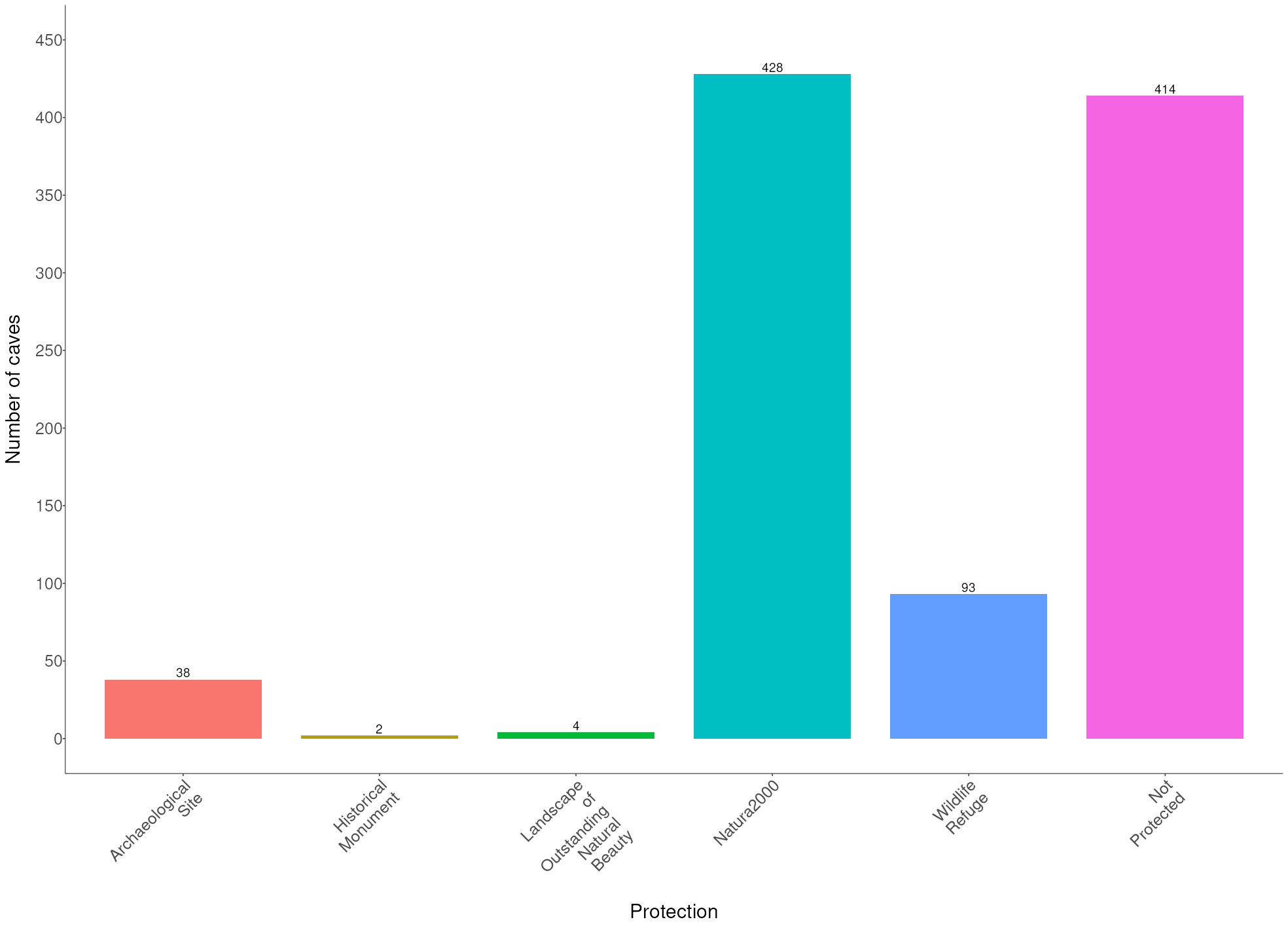
Conservation
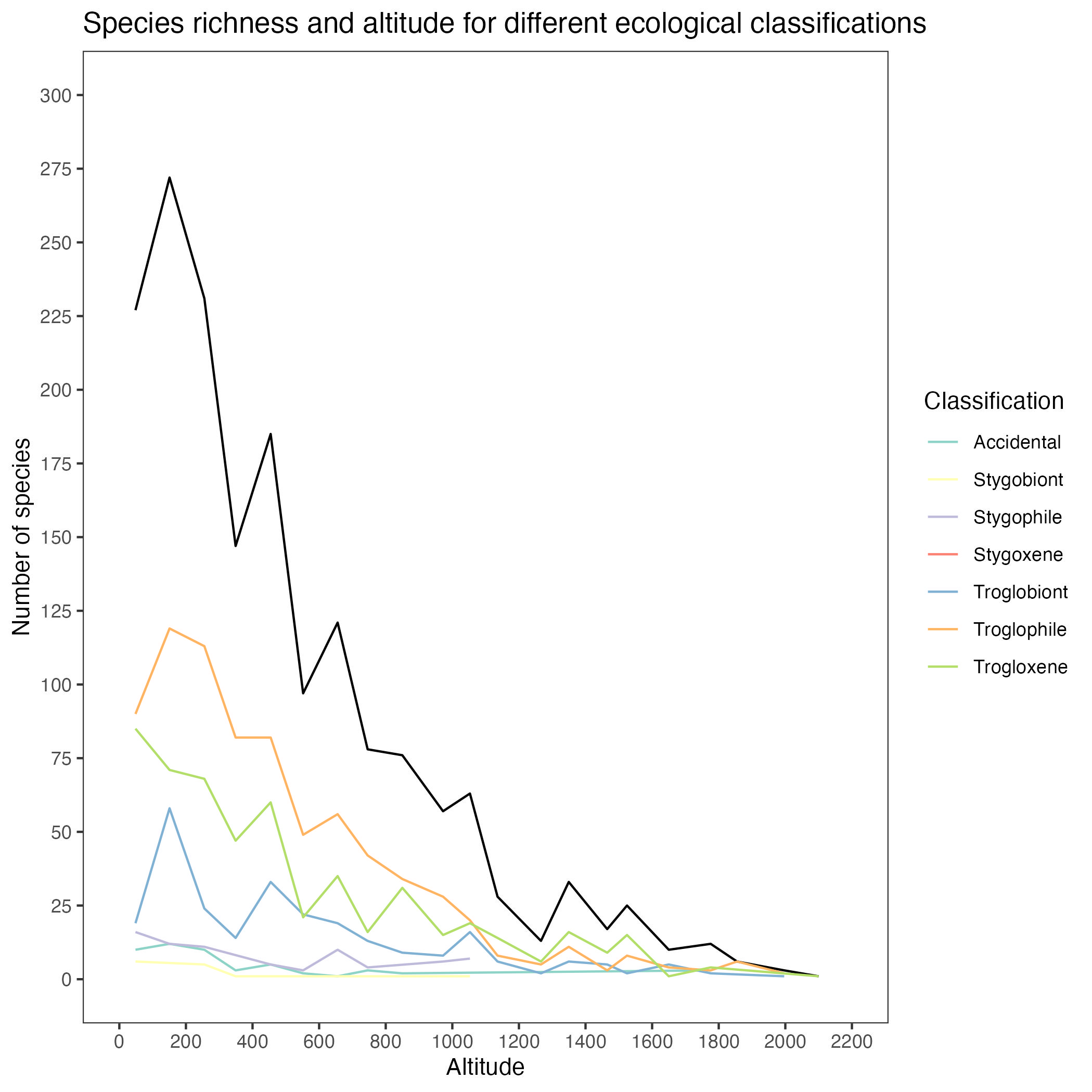
Altitude